
Select an existing photo, or, tap the camera icon to take a new photo. Photos taken and assigned to waypoints are stored in the phone's photo library. The route waypoint list shows a thumbnail of your photo. Long tap the photo for a larger version of the photo is displayed along with the waypoint name and notes. On the map display, tap a waypoint to display your photo of that location. If no photo has been assigned, a satellite aerial image of that location displays.
- Plan jogging paths, hiking, and cycling routes.
- Track walks, runs, bike trails, cross country skiing using the phone's GPS
- Display average and current speed, elapsed time, distance, course, altitude
- Save current position to return to, for example "Where'd I park my care?"
- Take photos of waypoints
- Map where you parked your car so you can return to that spot easily.
- Export waypoints and track to standard GPX file format
- Share location with social media or email
- Add / delete waypoints
- Edit waypoint notes as you go
- Save multiple routes and tracks to phone or SkyDrive
- Open previously saved routes later
- Import GPX files to analyze interesting routes and tracks from friends or sharing sites
- Use routes and tracks from sharing sites.
- Home Health Care routes
- Delivery routes
- Pick up routes
- Review and relive your past hikes, trips, adventures.
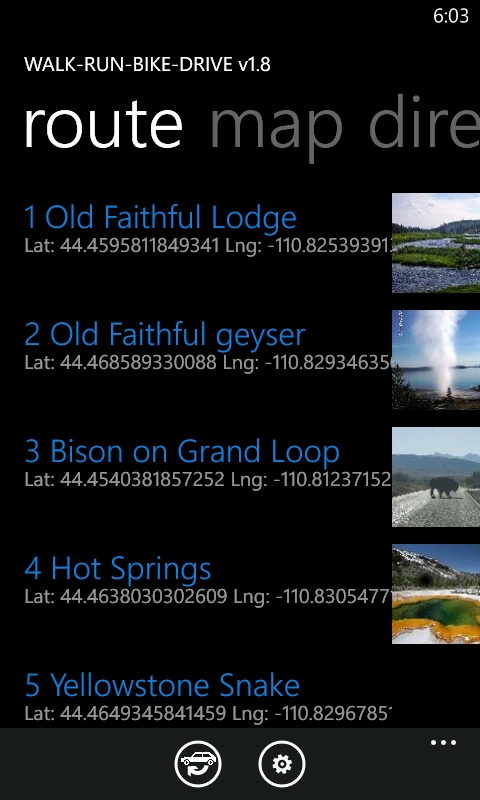
Walk-Run-Bike-Drive gives you several ways to quickly build a list of multiple addresses, or "waypoints". You can enter an address manually, pick from the phone's contact list, use the current GPS location (and find its address), enter a latitude/longitude, and select from saved favorite routes. Entered waypoints can otionally be saved to your phone's contact list too.
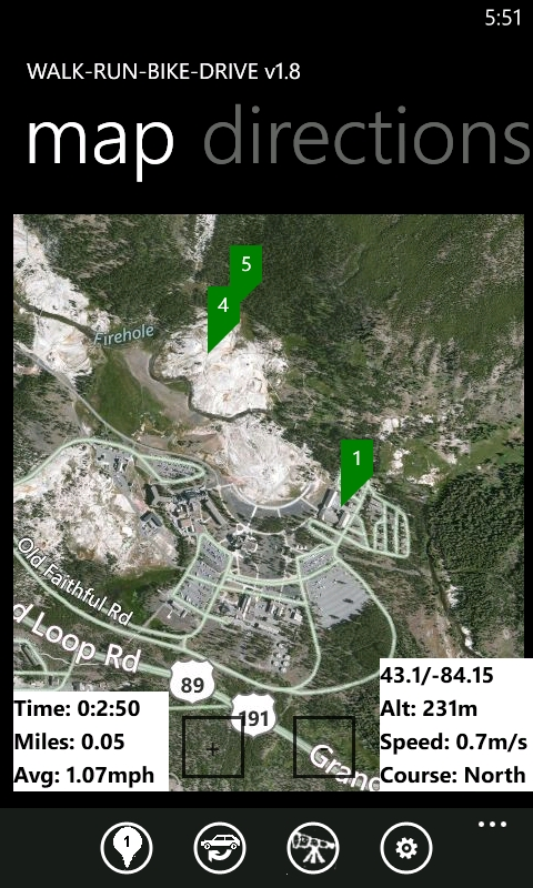
To view your progress, switch to the map view and turn on tracking. Your track is marked on the map as you go. Elapsed time, distance, altitude, course, current and average speed are displayed and updated as you walk, run, bike, kayak, or drive.
Maintain notes for each waypoint. Save multiple routes and export GPX to SkyDrive, phone, or clipboard for sharing, emailing, and uploading to sharing and tracking web sites, or just for your own personal record keeping.
Save any number of routes that can be opened later. Exported GPX files are compatible with many web sites featuring sport tracking and sharing, such as:
DailyMile.com - Free import/export sharing GPX
gobreadcrumbs.com - skiing and hiking trails
MapMyRide.com - Bike routes
strava.com - Bike routes
everytrail.com - Hiking trails
bing.com/maps - Bing Maps MyPlaces
Check out your friends travels by importing their GPX files. Examine routes and tracks you would like to try out -- view them on your phone, or modify them by adding your own waypoints.
Download the free trial at:
http://windowsphone.com/s?appid=395e46dc-09dd-4fcb-b8cb-bf9c826ec7ea
App web site with description: Walk Run Bike Drive ? Route Planner | Windows Phone 7 Route Planner ? Tracker
Download free version at: http://windowsphone.com/s?appid=b0fdde96-88c5-46c9-bdea-0fd67cf96ea1