[Free App] GPSMisc - A handy waypoint tracker & speedometer

cos wa

Banned
Apr 28, 2014
20
0
0
Visit site
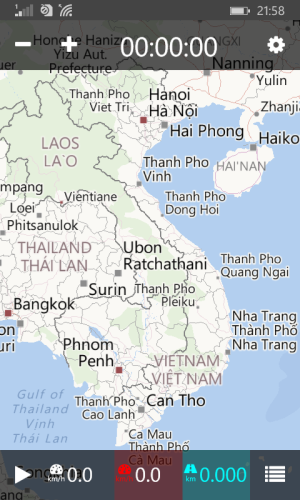
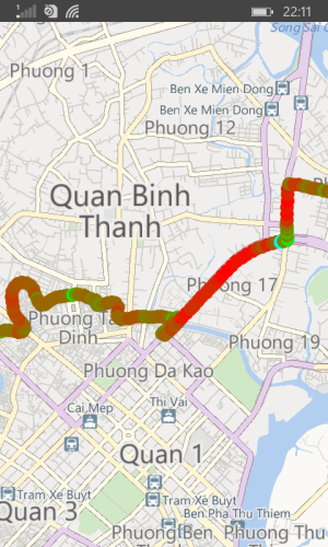
Hi guys, I'd like to share my new Windows Phone app - GPSMisc.
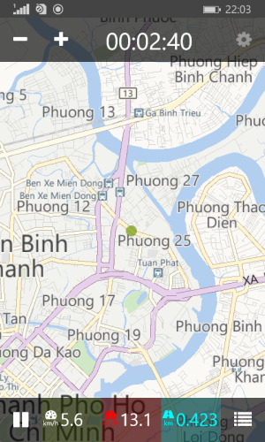
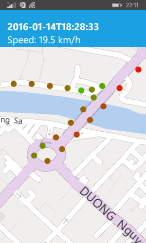
GPSMisc is just a small tool to track the position, speed and distance.
It was inspired by my bicycle riding hobby. It helps me know how fast I can ride, how far I have ridden, and the route I have passed.
It is a perfect speedometer alternative for bikes, I think :p
Hope that someone finds this tool useful :)
* Privacy Policy: GPSMisc collects positions (including speed and heading) and saves them locally on your device so that you can review your route history.

https://www.microsoft.com/en-us/store/apps/gpsmisc/9nblggh5ftmq
download.png

wp_ss_20160114_1.png wp_ss_20160114_2.png
wp_ss_20160114_3.png wp_ss_20160114_4.png
wp_ss_20160114_5.png wp_ss_20160114_6.png
 

Attachments

  • download.png
    download.png
    807 bytes · Views: 20

cos wa

Banned
Apr 28, 2014
20
0
0
Visit site
Thank you for paying attention :)
yes, it stands for speed, through green to red, the redest dot is the max speed way point
 

gpobernardo

Active member
Jan 12, 2013
4,339
0
36
Visit site
Thank you for paying attention :)
yes, it stands for speed, through green to red, the redest dot is the max speed way point

I just tested your app and let me congratulate you for a job well done! It's now one of my favorite GPS tracking apps (I have two out of the numerous out there). Not bad for a first version (is it?). Features I like the most:
- runs in the background
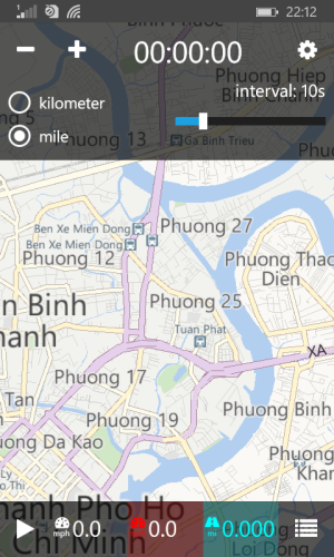
- ability to choose tracking interval
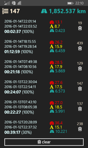
- auto-saving of track (useful when the app is accidentally closed, which I did)
- doesn't crash!
- color of points change with speed - very useful for visualizing travel quality, e.g. traffic conditions while driving.

Although this started as a biking app (I guess that's why the higher speeds are red), this also has a lot of potential as a driving app in monitoring driving quality and traffic conditions from the trip. But for driving, the color scheme for the speed should be reversed. Here are a few suggestions:
- add the ability to change the color for the speed, e.g. maybe red for slow speeds and then green as it reaches a certain speed (e.g. at 80kph), and then violet when the speeds are above 100 kph, and then black when the speeds are above 500 kph (when in an aircraft);
- 5-second interval is good enough, but maybe a 1-second interval is possible (just for flexibility);
- ability to export saved tracks as .gpx (or similar file format that can be used in other map platforms)
 

cos wa

Banned
Apr 28, 2014
20
0
0
Visit site
thanks a lot for these valued comments and suggestions 😊
Here I'm in the Lunar New Year holiday, so I'll try to make an update soon after these days. Thanks again 😊
 

gpobernardo

Active member
Jan 12, 2013
4,339
0
36
Visit site
thanks a lot for these valued comments and suggestions ��
Here I'm in the Lunar New Year holiday, so I'll try to make an update soon after these days. Thanks again ��

Happy Lunar New Year to you then. We're also going to celebrate that here, especially in China Town. :smile:
 

cos wa

Banned
Apr 28, 2014
20
0
0
Visit site
Hi, I've just updated the app to version 2016.02.21. Please have a look if you are still interested. Thank you again :p
 

gpobernardo

Active member
Jan 12, 2013
4,339
0
36
Visit site
Hi, I've just updated the app to version 2016.02.21. Please have a look if you are still interested. Thank you again :p

Great, thanks! Speed color customization is perfect! Now it'll be easier to visualize trip "health" based on traffic conditions during the trip, e.g. red for segments with heavy traffic.

Noticed the new "Line" mode, but the color coding for speed seems to be not working well with it. The dots works perfectly, though.

I noticed, though, that when the number of waypoints becomes high (probably over 100), the app becomes a bit laggy. Not a big deal, but may be worth looking into.
 

Members online

No members online now.

Forum statistics

Threads
323,273
Messages
2,243,555
Members
428,053
Latest member
JoshRos