Considering buying, BUT...

nadroj915

New member
Nov 28, 2013
95
0
0
Visit site
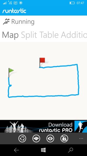
I'm considering buying the MS Band 2, but one thing I'm particularly interested in is the GPS tracking. Are you able to map your runs, and view the maps? If so, are the maps being powered by Microsoft, Google or other? The reason this is an issue for me, is that I live and work in China. I've tried out several other running apps - just using my phone (Lumia 950 XL), and it seems EVERY app uses Google maps for the GPS map tracking feature. Since, Google services are blocked in China, I'm actually unable to view any detailed map data after I've run. (See attached screen shot of the Runtastic app I've used). However, Microsoft's own "Maps" app (included on my device) works just fine for me as far as being able to see detailed street view data.
wp_ss_20160512_0001.jpg
 
Last edited:

rory753

New member
Nov 12, 2012
349
0
0
Visit site
the short answer is yes, but the longer answer is it depends. band 2 exports your data to the cloud, and then you can use a service to see detailed information of your run, whether through the health app itself, or other apps. personally, i use strava, and enjoy that service(it also uses google maps). I say it depends, because the service has to be working to get the data. I'm not sure runtastic does or does not integrate with microsoft health/the band. some partners are listed here:
https://forums.windowscentral.com/e...nd%2Fen-us%2Fpartners-and-apps&token=9Rpl-LIO

there are ways to get the data and turn it into gpx and do manipulation, but i haven't looked into those. you can dig in the forums.

long story short, you'll get some really good data from using the band, and be able to see if on google maps, i'm just not sure if it will be runtastic specific that you can see it.
 

DeNachtwacht

New member
Jan 15, 2014
86
0
0
Visit site
Both the website (dashboard.microsofthealth.com) and the Microsoft Health App use Bing maps. So as long as China doesn't start blocking them, you'll be fine.
 

AndrewMBaines

New member
Nov 22, 2013
58
0
0
Visit site
You can download your routes as GPX file from Microsoft. Then view in pretty much anything you like.
I'm now trying to find a way to tag my photos automatically from this.
 

Members online

Forum statistics

Threads
323,257
Messages
2,243,532
Members
428,052
Latest member
ayven